Feature layers |

|

|
|
Feature layers |

|

|
Feature layers let you add geographical detail to your spatial data plots, for example, you may want to include roads, rivers, railway lines and land faults to help you visualise your mine. After importing feature layers into XPAC, you can include them in your spatial data plots (see Layers tab for more information).
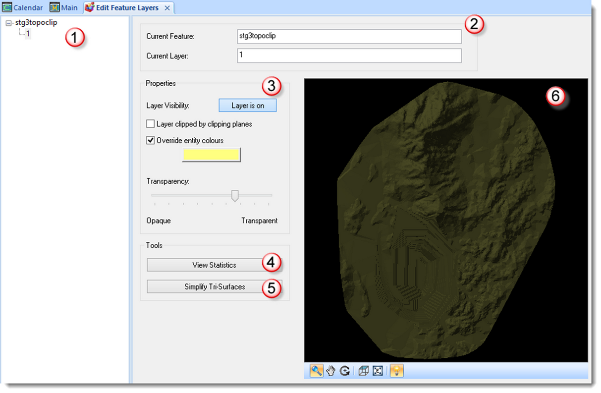
The Edit Feature Layers window lets you preview and apply minor changes to feature layers in XPAC. To open the window, select View > Feature Layers:

Section |
Area |
Description |
|---|---|---|
|
Feature Layer Tree |
Displays all feature layers in the XPAC project in a tree structure. |
|
Feature layer information |
Displays the selected feature and layer in the record tree. |
|
Layer Properties |
Lets you specify the properties of the layer, for example, whether XPAC also clips the layer when using the clipping tool in a spatial data plot. See Changing the properties of a feature layer for more information. |
|
View Statistics |
Displays statistics for the selected item in the record tree. |
|
Simplify Tri-Surfaces |
Opens the Simplify Tri-Surfaces dialog, allowing you to simplify the tri-surfaces in the currently selected layer. See Simplifying Tri-Surfaces for more information. |
|
3D Scene |
Displays a preview of the data for the selected layer. You can use the tools in the 3D Scene to view the feature layer from other angles. See Using the tools in the preview window for more information. |