Importing and exporting feature layers |

|

|
|
Importing and exporting feature layers |

|

|
XPAC allows you to import and export feature layers so that you can add geographical detail to your plots, and export them so that you can transfer them between XPAC projects.
Importing feature layers
1.Select File > Import > Feature Layers. A Windows Explorer window displays.
2.Navigate to the folder containing supported formats, for example the DXF or 00T file.
3.Select the file/s and click Open.
XPAC imports the file and displays the Edit Feature Layers window (see Feature layers for more information). The structure tree displays each feature layer, and stores any layers within the file as sub-layers. You can now set the properties for each feature layer and include feature layers in plots, also update preschedule from stage plan.
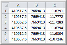
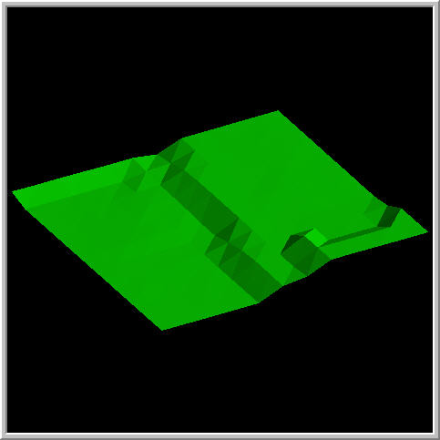
XPAC will create a surface from all supported importing formats, for Example :
| • | CSV Grid |

To a surface in feature layer :

Exporting feature layers
1.Select File > Export > Feature Layers. The Select Feature Layer To Export window displays.
2.Select the feature layer that you want to export.
3.Click Select. A Windows Explorer window displays.
4.Navigate to the folder in which you want to save the feature layer.
5.Type a name for the file.
6.Select the file type that you want to use from the Save as type drop-down list, for example, Vulcan Binary Tri-Surface Files (.00t).
7.Click Save.
XPAC saves the file in the specified folder
Below are the list of export format to Feature Layers and import format from Feature Layers :
Importing File Formats to Feature Layer |
Feature Layer |
Exporting File Formats from Feature Layer |
AutoCAD DXF |
AutoCAD DXF |
|
Vulcan Tri-Surface |
Vulcan Tri-Surface |
|
MineScape Grid |
|
|
Minex Grid |
|
|
Carlson Grid |
|
|
Vulcan Map Grid |
|
|
Vulcan ASCII Grid |
|
|
Vulcan Binary Grid |
|
|
CSV Grid |
|
|
Datamine Grid |
|
|
Surfer ASCII Grid |
|
|
Surfer Binary Grid |
|
Related topics |