You can calculate the distance between two points on a spatial data plot by clicking Measure Distance on the 3D Graphics toolbar.
| 1. | Reposition the spatial data plot. Either: |
| a. | Click on the 3D Graphics toolbar; or |
| b. | Select , then select a view option, for example, . |

|
You will not be able to measure distance if you select from this menu.
|
| 2. | Click Measure Distance on the 3D Graphics toolbar. |
| a. | Click where you want the measurement to start. |
| b. | Click where you want the measurement to end. |
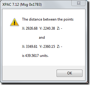
XPAC calculates the distance between the two points:


